I took used some PTO at work to make a 3 day weekend, and Amber and I decided to head East, over the Continental Divide to explore some more of Montana that we'd never seen before. Our main destination was Great Falls. We took US 2 over the Rockies and then hooked up with 89 and traveled along what is called the "Rocky Mountain Front". The edges of the mountain range is so abrupt as it towers over the gorgeous plains. There are spur roads to get even closer, but we didn't have time on this trip.
We arrived in Great Falls around noon, and our first destination was the Lewis & Clark National Historic Trail Interpretive Center.
The Interpretive Center gave an excellent overview of the entire expedition, but also focused on the big moments that occurred in what would later become the Great Falls area. Clark had heard stories from the American Indians about a "great falls" upstream on the Missouri River. Upon finally reaching the area and scouting it out it was discovered there were five falls. The hopes of a half day of portaging around were dashed. Instead began the month long journey to portage 18 miles around all of the falls. It was an excruciating journey, but more on that later.
After wrapping up our time at the Interpretive Center we continued on to Giant Springs State Park. It sits just upstream and was a quick drive over. Lewis & Clark described it as what was surely the largest spring in the world, with the water so pure and clear it could still be discerned a mile down the river.
The water emerges on the bank, and some of it flows down into the river. The rest has been diverted to flow a few yards and then joins the river. It has been dubbed at one point the world's shortest river. The water has been traced to snow melt from the Little Belt Mountains about 30 miles to the south of Great Falls. And I'm not sure how they determined this, but they claim it takes 25 years for the melted snow to emerge from the spring. It stays a constant 51 degrees year round; so even in the dead of winter the area around the spring is pleasant.

After finishing up in town we ventured off the beaten path a bit to go see some more history. Our first stop was to "The Great Falls". It was the first waterfall Lewis & Clark would have encountered. We journeyed down some beat up roads before finally arriving at the site. Today there is a hydroelectric dam sitting above the falls, but you can still get a sense of what the expedition was faced with. There was no way to get a dugout canoe up those cascades.
After finishing up there, we continued on down the beaten path to reach a trail head parking for Sulphur Springs. Sulphur Springs is where the Lewis & Clark Expedition stopped and
gave Sacagawea some of sulfurous spring water. She had been deathly ill for a period of the trip, and miraculously the spring water that was administered cured her. We, however, did not make it out to the spring. It was late in the afternoon and hot, so we opted to just hike to the overlook.


Down below, next to the river, is where the Lewis & Clark Expedition had made their camp while they debated what to do about the falls on the river. It was from this point that they started their 18 mile portage that took them almost a month. There was a lone cottonwood tree growing by the river that they cut down to form wheels with which to roll their canoes across the rugged landscape. And it wasn't just from point A to B. It involved numerous trips back and forth. All along the way you can still see the yucca and prickly pair cactus that covers the unforgiving landscape. The high June temperatures, cactus thorns stabbing into your feet and causing infections, and skin and fingers rubbed raw all contributed
to the miserable month long experience. But these men were determined to push on at all costs.

At this point our day was winding down, and we went back into Great Falls to check into our Airbnb for the night. We got a good deal on our own private room in a couple's home. Their kids are all grown now, so they rent out their bedrooms. We even got a coffee maker, mini fridge/freezer, and microwave in our room so it worked out well for keeping our groceries cold. And after a quick jaunt to Perkins for dinner, we were able to warm up apple pie for dessert.
The next morning we were up and off to First People's Buffalo Jump State Park. It was about 20 minutes outside of Great Falls.
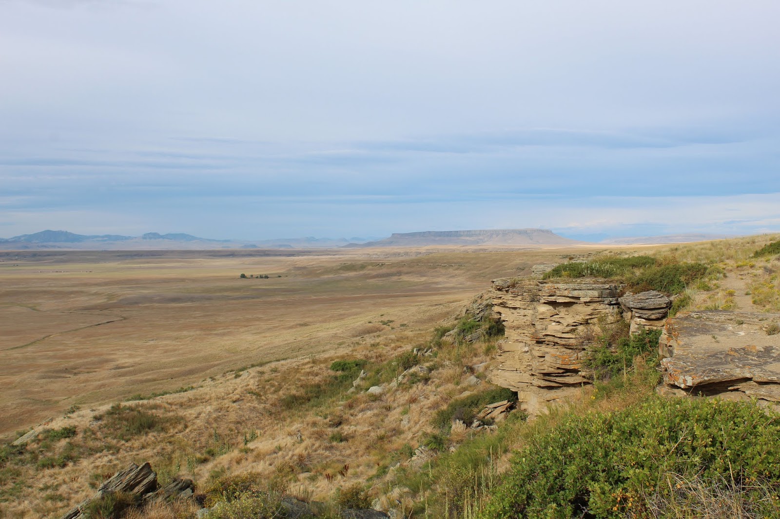
This was the first buffalo jump I had ever visited. We started off up on the top overlook (Our GPS had directed us there first, instead of the main visitor center below). As we strolled along it was easy to see how bison could be confused. It really looked like a gentle slope down the prairie until the last few yards. At that point a mile long cliff stretched out in front of you. The American Indians who ran with the herd would leap over the edge and try to take shelter on ledges as hundreds or thousands of bison fell to their death & injury below. Once the run was over, the tribes would butcher and clean the animals below the cliffs. Thousands upon thousands of remains have been excavated.
Despite the gruesome history and use of the area, it was quite a beautiful and cool morning. Amber and I spent time hiking along the bottom of the cliffs, and then walking along the top.
After finishing up top, we made our way back down to the Visitor Center and explored the exhibits and learned more about the known details on the tribes that used the jump, the processes involved in herding the bison, and the history of the extermination of the bison on the American Continent. Then it was back on the road to head an hour south to the Little Belt Mountains...