Monday, June 7, 2021

Idaho Road Trip Part 1

 It was finally long overdue for the Holcomb family to hit the road again, and do some exploring.  This was going to be our first big trip since Adelaide was born in March of 2020, and we weren't sure quite what to expect.

We left home on Friday morning and didn't have much in our plans expect stopping for lunch at Stanley Lake.  I had never seen the lake before, and the Sawtooth Mountains are my favorite peaks in the whole country.

We arrived at my parents house Friday evening and we enjoyed a few days spending time with them, visiting some of Amber's relatives, visiting some childhood friends & people from church, and spending a day in the Owyhee Mountains hunting for rocks (I didn't take any pictures during this time).

On Tuesday my parents joined us as we began our road trip across Idaho.  The plan was to visit a few places that I had never made it to, despite growing up in Idaho.  We followed HWY 78 that took us through some beautiful country, before arriving at our first series of destinations for the day.  I wanted to see some of what Thousand Springs State Park had to offer.  The park is composed of quite a few different areas spread out across an area of Southern Idaho.  I had visited Box Springs Canyon years ago, but I hoped to see a little bit more.

We started out with eating a picnic lunch at Malad Gorge, and then doing a quick walk across the foot bridge.


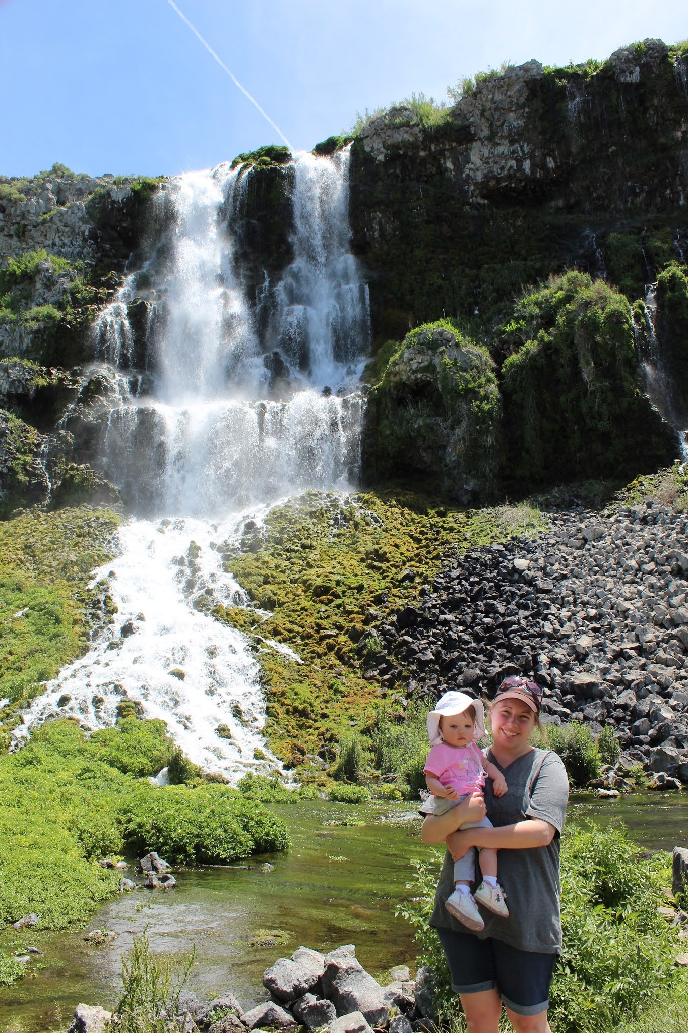
My parents decided they wanted to see the Ritter Island section of the park so we headed there next.  A lot of the old homestead buildings weren't open for touring at that time, but we were able to see one of the many (Hence the name "Thousand Springs) impressive springs spilling down into the Snake River Canyon.  The water is believed to originate to the North where multiple rivers disappear into the porous volcanic basalt.  It reappears an estimated 100 years later in all these springs to the South.


After spending some time at Ritter Island, we moved on to visit Hagerman Fossil Beds National Monument.  Sadly the Visitor Center in Hagerman, ID (where you can view the fossil remains of the Hagerman Horse) wasn't open.  But we were able to go out to the Monument land and hike along a section of the original Oregon Trail where you can still see the wagon ruts worn into the ground.  It was pretty neat to imagine the struggling West-bound pioneers treading the very ground in front of us over 160 years ago, and to see the evidence still preserved.

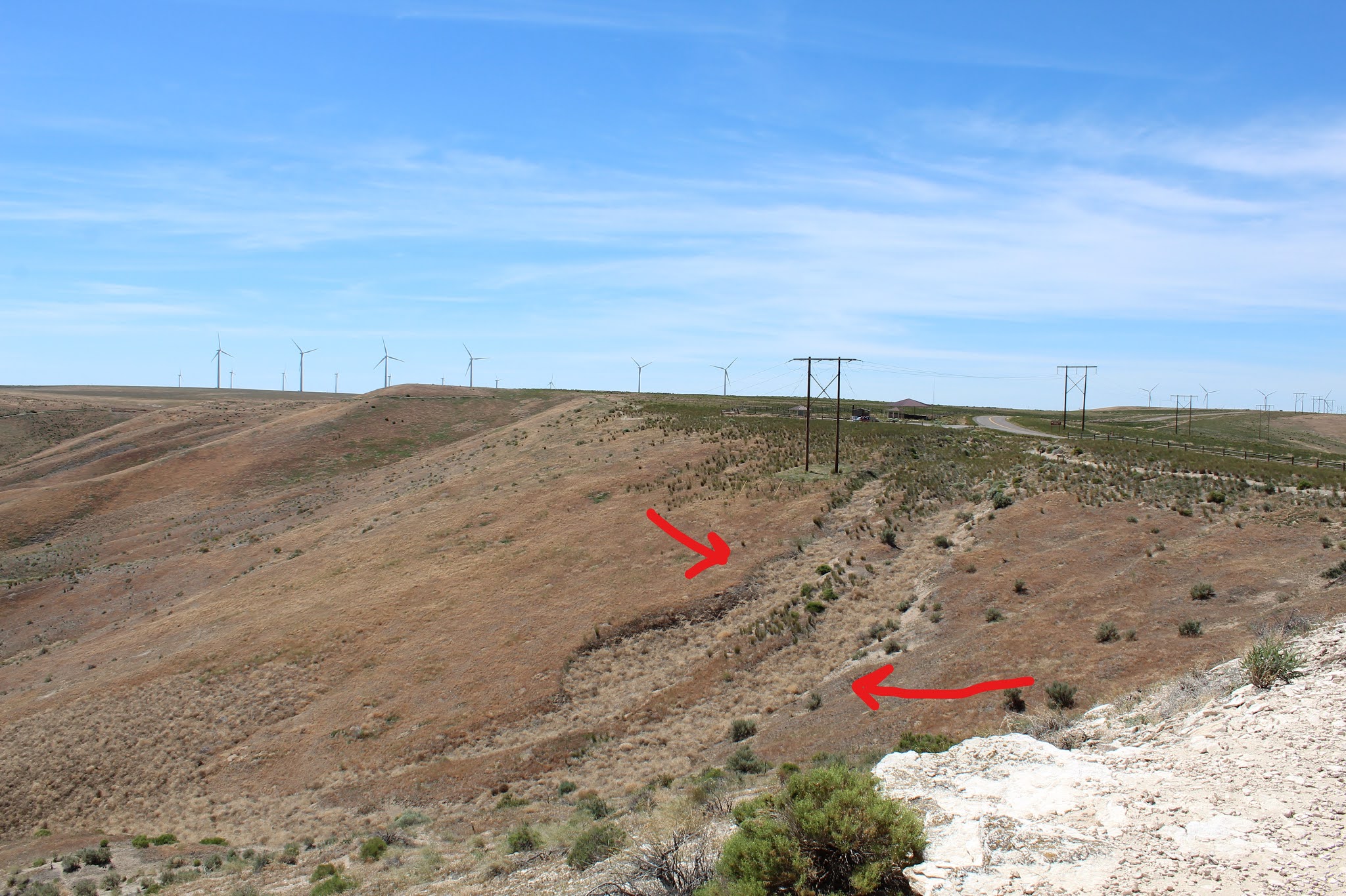

In regards to the National Monument's name sake, it's a bit tricky to weed out all the evolutionary speculation and get to the truth.  Starting in 1929 excavations began after a local rancher had showed fossils to a government geologist.  To date the fossil beds have produced 20 complete Hagerman Horse skeletons.  The banks where the fossils are found are an area of exposed sedimentary rock beds immediately above the Snake River.  Buried on top of these sediment layers is the expansive volcanic rock that is found all over Southern Idaho.  At least from a basic geologic perspective the area must have been a massive burial location during Noah's flood: Whether that was due to bodies accumulating in this one particular area as a result of a water blockage, or it was a false vestige of safety for the animals fleeing the rising flood waters, and they were then buried there.  Most likely Post-flood volcanism then buried the surrounding area, covering up a lot more of these sediment layers.

Hagerman Fossil Beds was our last stop for the day.  So we headed to Twin Falls where we had an Airbnb reserved for a couple nights.  We all tried to relax and get some sleep for the next day's adventures.

Sunday, July 12, 2020

First Adventure in the Bitterroot Range

After completing my first week of work at my new job in Hamilton, Montana, it was time to enjoy the lovely weekend!  A coworker had recommended a hike to an overlook that wouldn't be too difficult with a baby, so we checked it out.  On the hike upwards we were treated to great views of the Bitterroot Valley, with the Sapphire Mountains to the East, and glimpses of the intimidating canyons before us that snake into the deep wilderness of the Bitterroot Mountains.


These imposing mountains are still almost the same as when the Lewis & Clark Expedition probed them for a suitable pass (which they found to the North of Hamilton, near present day Lolo).  But for us, it was a nice stroll through the forest and enjoying the stunning beauty of God's creation.  As we got hire up more wild roses and lupine were everywhere.


Upon reaching the top of the overlook, the beauty of the canyon stretching into the wilderness was breathtaking.  The distant peaks that were visible sit in Idaho, and it's the beginning of a vast tract of virtually untouched land for over 100 miles.


After enjoying the views for a while and giving Adelaide time to not be cooped up in the carrier we headed back down the trail.  Addie conveniently slept most of the hike down.  And on our way back down the trail we began to hit lots of hikers on their way up.  One thing that has struck Amber and I about this area is how friendly, genuine, and level headed everyone here is.  I've long known that Montanans have a reputation for being friendly and kind, but here in Ravalli County we are blown away by it all.  It doesn't matter if it's fellow Christians, random strangers, cashiers in the grocery store, hikers on a trail, or your own neighbors.  For the most part life goes on here much like normal, people have the freedom to live life how they see fit and don't judge others who disagree, people recognize the importance of family bonding, and their is a huge sense of patriotism still alive in this part of the country.  It's the three F's.  Faith, Family, & Freedom are alive and well here.  It's so refreshing and makes me all the more excited to think about raising our family in God's country.

Saturday, July 4, 2020

Fort Owen State Park

Now that we are settled in Hamilton, we had our first family outing to Fort Owen State Park, which is just a 20 minute drive up the valley, in Stevensville.


Fort Owen's claim to fame is a lot of Montana's firsts: First white settlement, first Catholic church, first grist mill, etc.  In 1850 John Owen came out west at a time when the mission was closing down.  He bought the land and over the course of the years he developed the fort.  It became an important haven to those braving the American frontier in subsequent years.  Owen had hoped that his fort would become the central hub for Western Montana, but those dreams did not last.  By the end of the Civil War, Missoula (just a 30 minute drive north today) was booming and becoming the new settlement that was connected to Eastern Washington via the Mullan Road.


As the fort's importance waned, and John Owen became poor in health and mired in debt, the area fell into disrepair.  The land eventually became owned by local farmers, who then donated it to the Stevensville Historical Society, and in turn to Montana State Parks.

Today the East Barracks building is the only original building still standing.  Excavations have taken place to unearth foundations and artifacts of this era of Montana frontier life.  A few replicas have been placed in this small park for visitors to explore on this mostly self guided experience.


If you find yourself in the gorgeous Bitterroot Valley of Montana, and have an hour of time to kill, this small state park is worth checking out if you're interested in American history and learning about the life of our ancestors as they settled the West.

Monday, June 15, 2020

Washington Coast

Friday June 12 marked the first time Amber and I would be getting out for an adventure, since before Adelaide was born.  We had found a good deal on a condo on the Washington Coast, in Ocean Shores.  That morning we set out from Pasco, planning on taking HWY 12 over the Cascades.  Without realizing it while driving, we ended up on 410.  This didn't become apparent for miles and miles until reaching the top of the pass and a sign welcoming us to Mount Rainier National Park.  It added extra driving time to our journey, but we did get to see some pretty waterfalls shrouded in clouds and rain as we descended, making our way through part of the Park to rejoin HWY 12.


We eventually made it out to Ocean Shores and got settled into our nice little condo.  It was situated in a quiet area just about 1/4 mile from the beach.  After making dinner and taking care of Addie we went for our first walk on one of the beaches that evening.

The next morning our only plans were to go around to Westport on the other side of the bay, in order to see another lighthouse.  It's known as the Gray's Harbor Lighthouse.  It's Washington's tallest lighthouse and was finished being constructed by 1898.  The Gray's Harbor Region relied heavily on logging operations and maritime traffic into the large bay necessitated the lighthouse being built.  Unfortunately due to COVID19 restrictions, we weren't able to go inside the lighthouse, or into the nearby Westport Maritime Museum which features the lantern lens from the Destruction Island Lighthouse farther up the coast.


The weather had been holding for a little bit longer (with more waves of rain coming) so we took the opportunity to walk a ways on a coastal trail in the state park that the lighthouse sits in.  We had gorgeous views of the ocean and could see the top of the lighthouse just clearing the surrounding trees.


After eating lunch and getting some souvenirs in Westport, we headed back to Ocean Shores.  We indulged in a little fresh seafood to go along with our leftovers for dinner and to cap the evening off we drove a short distance to another state park to enjoy another walk on the beach.  It was partly sunny but cool, and another storm was swiftly arriving from out in the ocean.


The next morning we packed up after breakfast and headed out, but decided to spend a little more time at the beach.  Since we are moving back to Montana, we are not planning on getting over to the ocean for a while.  So we made the most of our time.  We waded in the water and enjoyed the nice morning.  We set Adelaide up in her chair and she helped us build a sand castle.


After we finished up, we said goodbye to the ocean and made the drive back to Pasco.  It was a very relaxing weekend, as Amber and I both got used to a new way of making memories and having adventures with a new member to our family.  We look forward to what the future brings as we get ready to settle permanently in Montana again.

Tuesday, December 10, 2019

Fur Trading & Last Oregon Lighthouses

The first weekend in December yielded warmer weather, albeit rain, and we managed to slip out of Pasco for a 3 day weekend.  We were headed to Harrisburg, Oregon, near Eugene, to visit and stay with some of Amber's friends for the weekend.

Friday morning we headed out through dense fog and decided to drive on the Washington side of the Columbia River, on Hwy 14, all the way to Vancouver.  The Washington side is very peaceful and quiet, compared to the craziness of Interstate 84 on the Oregon side.  We had never driven this entire stretch, so it was a chance to cover some new ground.

Upon arriving in Vancouver our stop was Fort Vancouver National Historic Site.


Fort Vancouver was established by the Hudson Bay Trading Company, a British entity, in an effort to cement British control over the disputed Oregon Country.  It was the major hub for economic & social policy in the Pacific Northwest, at its time.  John McLoughlin was the primary overseer and tasked with maintaining the fort and keeping out American settlers.  As more settlers poured over the Oregon Trail, however, this became an impossible task.  Great Britain did not want to fight a 3rd war with the United States and eventually ceded the Oregon Country to the U.S. along the 49th Parallel.  This left Fort Vancouver suddenly in the center of the United States.  The fort continued to operate in subsequent years, but its decline was inevitable.  It was ultimately taken over by the military.

Today the fort's buildings and stockade walls have been reconstructed in their original locations.  We toured the grounds of the fort, and got some live demonstrations from blacksmiths working with era tools & materials.

The park features more buildings including a small air museum at Pearson Field (which we explored), and other military barracks and buildings (that we didn't have time to check out).


After our time at Fort Vancouver, we continued south to Harrisburg.  Amber was attending a Christmas party with her friends Evan & Adrienne and I rolled solo for the night.  The next morning Adrienne joined us to make a quick trip over to Newport, on the Oregon Coast.

Our main reason for heading to the coast was to get the stamps in our lighthouse passport book for the Yaquina Head & Yaquina Bay lighthouses.  We had visited before, but also never been able to do tours inside.  This trip, however, would fix all that.  The three of us visited Yaquina Head Lighthouse first.  It was first lit in 1873 and had a first order Fresnel lens.  While we waited for our tour we explored the Interpretive Center, and then I braved the rain and hiked around on a beach and took some pictures.


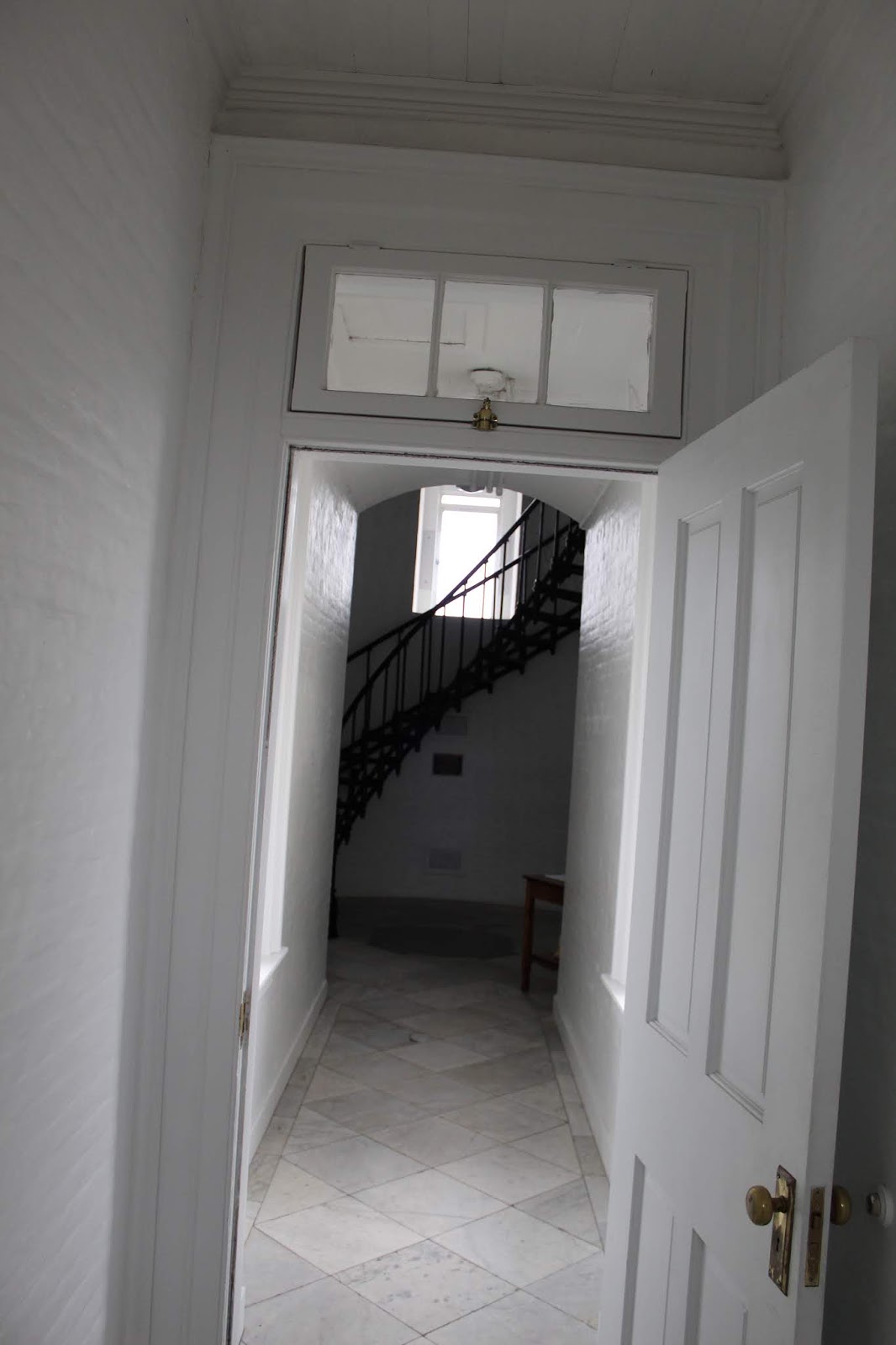
When the tour began we were all glad to get out of the wind and rain and be let inside the lighthouse.  We started gathered in the old oil storage room, then transferred to the keeper's office quarters, and finally topped it off with a climb to the top of the tower.


When we finished up our tour of Yaquina Head Lighthouse, we headed back into Newport to visit the Yaquina Bay lighthouse.  Amber and I had seen it from the outside on our honeymoon, but this time we were able to go inside and do a self guided tour and get our passport stamp.

Yaquina Bay Light was built in 187, and it was decommissioned in 1874, only operating for three years.  The bay lighthouse was difficult to spot by ships approaching from the north, so the Yaquina Head lighthouse was the solution.  It became obvious pretty quickly that having both lighthouses manned would be a waste of resources, so it was shut down.


Our last stop was downtown Newport to grab a filling late lunch of seafood at the local Mo's, before we drove back inland to Harrisburg.  Amber and I spent the evening with Evan & Adrienne again before we drove back to Pasco the next morning.

Sunday, October 27, 2019

Ginkgo Petrified Forest

Amber and I set out for a Saturday adventure to a Washington State Park only 1 1/2 hours from Pasco.  I've driven by it numerous times, but this was our first time to visit what is called Ginkgo Petrified Forest State Park.


It can be difficult to sort out the things that obviously don't line up with a Biblical timeline of the earth's age, but the park nonetheless gives you a fascinating perspective into what Eastern Washington used to be like.

At some point in the past, Eastern Washington used to be a more lush landscape.  At that time the Cascade Mountain Range either didn't exist, or they were much lower and the moisture wasn't prevented from reaching the interior as it is today.  It would have been a landscape of tall forests, lush plant life, swamps & bogs, and more.  Scientists believe that the area today preserved as the state park was probably a log jam instead of an actual grove of ancient trees, due to the immense spectrum of tree species that have been discovered (Possibly a result of Noah's Flood, I can't help but wonder). 

Today petrified elm, oak, douglas fir, redwood, sweet gum, walnut, and of course the park's namesake ginkgo have all been found here.  It is unlikely that all this variety grew in this one location.


At some point after this the series of cataclysms that shaped Eastern Washington into what we know today, began.  It's just my opinion that, based on a post Noah's Flood world, the resulting events happened.  Plate tectonic forces were created after the "fountains of the deep" broke open.  That led to the creation of the Cascade Mountain Range.  Lava spewed all across the Pacific Northwest.  As the mountains got higher, the interior became drier.  Scientists think that as the lava poured across Eastern Washington, the big log jam at Ginkgo State Park was protected from the lava by the bog environment.  The lava cooled rapidly from the high water content and effectively sealed the logs underneath.

As layer upon layer of lava continued to pile up, minerals percolated down to the logs and the process of petrification began.  The lack of oxygen allowed the minerals to penetrate and transform the logs into stone.  Today they are solid rock, but retain their wood grain structure.


At some point another great change in Earth's history occurred.  Again, it's my opinion that in the post flood world one of the results was the ever changing weather and climate.  We still feel the effects today, but not as extreme as right after the flood.  The evidence is undeniable that great ice ages did occur: scientists just don't agree on the timeline of them.  I prefer to look at it from a biblical perspective, of course.

In this new frozen world of North America, giant ice dams were formed.  All across Washington, Idaho, and Montana the evidence of this lake/lakes can be seen.  As the lakes filled up the ice dams eventually broke, resulting in massive floods across the Pacific Northwest.  The processes was repeated again and again.  The massive flood waters scoured away the landscape forming the step-lands & coulees all across Eastern Washington.


How does this relate to Ginkgo Petrified Forest?  It just so happened that as the flood waters stripped away the deep layers of basalt laid down by the volcanic eruptions, they eventually cut down to the layer in which the preserved trees were buried.

Fast forward to 1927 when construction workers who were working on building highways noticed exposed sections of the petrified trees.  This led to further scientific study and excavations.  During the Great Depression the Civilian Conservation Corps handled a lot of the excavations, trail & museum building, and opening the area up to the public in 1938.  Today is is much the same and you can come and tour the landscape and get a glimpse for yourself into Washington's fascinating history & geology.

And of course, this only wets my appetite for discovering more about Eastern Washington's unique topography and seeing more of the landscape that was sculpted by this immense floods that probably occurred at the same time many of the stories in the Bible were taking place.  I'm sure there will be more adventures into the dry interior of Washington to come...

Monday, October 14, 2019

Mouth of the Columbia River

This past weekend, Amber and I were up at 4am to do a quick trip out to the Pacific Ocean.  We left Pasco, and it took us a little over 5 hours to get to Astoria, Oregon.  Astoria sits right by the mouth of the Columbia River and is known for being the oldest settlement west of the Rocky Mountains.  We had two main goals for our quick weekend trip. 1. See every lighthouse in the area and get our USLHS Passport stamps, and 2. See more Lewis & Clark history.

We started off by heading to Cape Disappointment, on the Washington side of the river's mouth, first.  In 1856 the first lighthouse, known as Cape Disappointment Lighthouse, was built.


The light was needed to help mark the entrance to the Columbia River.  According to somebody above my pay-grade, the Columbia River Mouth is the 2nd most dangerous in the world.  The only one more dangerous is the mouth of the Amazon River in Brazil.  Because the Columbia carries so much silt and sediment when the river meets the Pacific Ocean it drops immense amounts that create ever changing sand bars.  These changing conditions combined with frequent storms create treacherous conditions for ships.  Over 2,000 ships have sunk in these waters off Oregon/Washington, earning it the nickname "Graveyard of the Pacific".

The new lighthouse certainly helped, but it could not be seen around the headland by ships approaching from the north.  To solve this problem, a second lighthouse was built on Cape Disappointment just 2 miles away as the crow flies.  It is known as the North Head Light.


After checking out the lighthouses, we crossed back over into Oregon to explore some more Lewis & Clark sites.  On their arrival to the Pacific, they combed over the whole region surrounding the mouth of the Columbia River.  For days they endured bad weather on the Washington side, until they made the decision to cross south and built a fort in which to spend the winter.  This fort was named Fort Clatsop, after a local Indian tribe.  They spent December o 1805 to March 1806 in this location.  Today, Lewis & Clark National Historic Park preserves the area they wintered, and a replica of Fort Clatsop stands, based on drawings and dimensions laid out in Lewis's journals.


We watched a film and explored the exhibits and some trails before continuing on our day of adventures.  We opted for Fort Stevens State Park.  It was created to preserve beaches and military installations.  Lots of bunkers, gun emplacements, and radar stations are all over the place.  They date back from the Civil War era up to World War II.  In addition, Fort Stevens is the location of a Japanese submarine attack during World War II.  The sub launched about fifty shells against the area before slipping away at night.

Amber and I had time to check out one of these emplacements, but our real focus was seeing Oregon's most famous shipwreck.  It was called the Peter Iredale.  She was a British steel sailing vessel enroute to Portland.  On October 25, 1906 she was waiting out a fierce storm that prevented her from entering the Columbia River.  The ship was driven ashore and became stuck in the sand due to the storm.  No lives were lost, but the ship was abandoned.  As a result it quickly became a tourist attraction.


At this point in our evening, we were about ready to call it a day.  We made a run to get gas and some candy before checking into our Airbnb room for the night.  We heated up some dinner, showered, and slept for about 10 hours that night.

The next morning we really only had one main goal for the day: Try to get a view of Tillamook Rock Lighthouse.  It was the last Oregon Coast lighthouse we had yet to see and get a picture of.  I had tried in 2012, but the viewing was obscured by the all too common bad weather.  It is a mysterious sentinel isolated over a mile offshore.

We headed down to Cannon Beach and attempted to find a historical marker/monument about the "Salt Works" where the Lewis & Clark expedition had sent men to boil sea water and obtain salt for their return in the spring.  But we couldn't find it, so we continued on.  We arrived in Cannon Beach and made the windy drive up to Ecola State Park.  Our plan was to hike Tillamook Head.  This was the farthest south Lewis & Clark explored, and he described Tillamook Head as one of the steepest hills he had ever climbed (funny since he crossed over the Rocky Mountains and they were much worse).

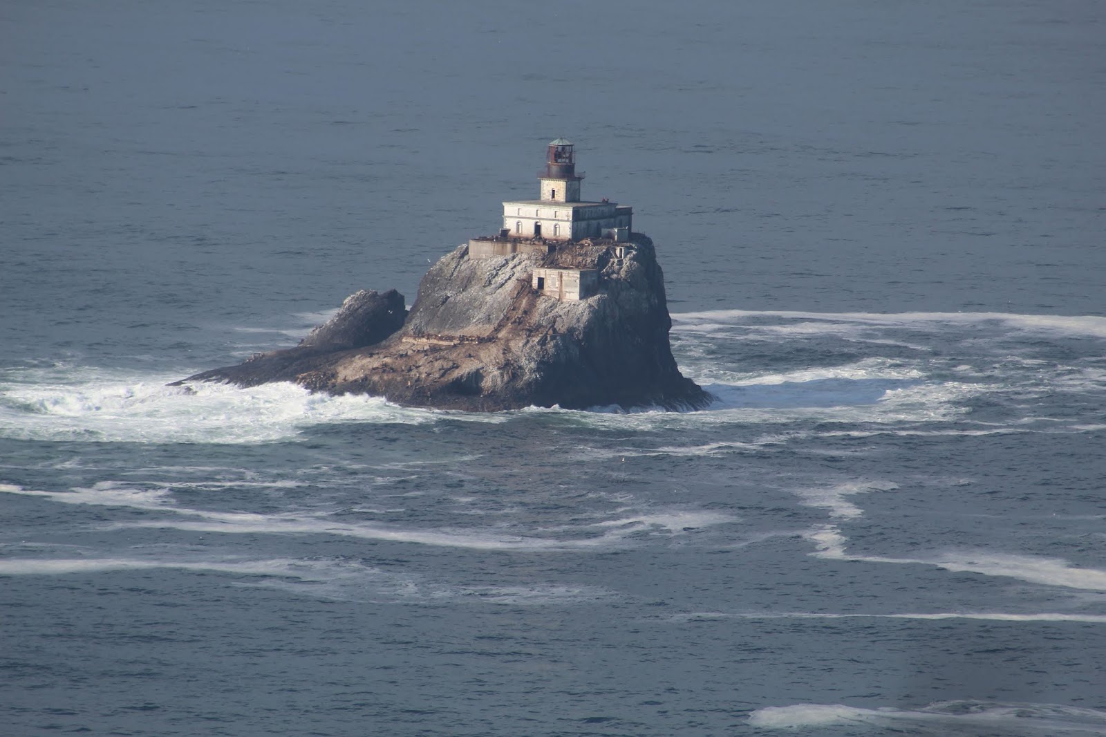
It was a gorgeous morning for a hike, and it was neat to think we were once again walking in the footsteps of the famous expedition.  At the top of the head we hiked a short spur trail and were finally rewarded with the view that I had wanted to see for years...


The Tillamook Rock Lighthouse was another aid to Columbia River navigation and it was finally lit for the first time in 1881.  The construction, upkeep, and stories surrounding this remote lighthouse is quite a remarkable story, surrounded by both fact and legend.  But it took workers 7 months alone just to level the top of the rock on which to build the lighthouse.  They were stuck on their island prison the entire time.  They lived in tented bolted to the rock and endured countless fierce storms.  Once the lighthouse was completed it quickly gained the nickname "Terrible Tilly" due to the horrible and lonely conditions.  The fierce winter storms routinely drove waves over the top of the lighthouse.  Supply runs were not consistent due to constant bad weather.

The lighthouse was deactivated in 1957.  Today it sits abandoned and decaying 1.2 miles offshore.  More often than not it is shrouded in fog and secrecy.  Being able to view it today finally meant that Amber and I had officially seen every lighthouse on the Oregon Coast.  We went into Cannon Beach to get out Lighthouse Passport Stamp, and then began the drive back to Pasco....

I will close this post with a video shot I was able to get with our camera.  I'm quite pleased with the quality considering the great distance offshore this lighthouse really is.