Tuesday, June 27, 2023

Great Basin National Park

 For a couple years now, a remote lesser known and visited National Park, in Nevada, called Great Basin, has been on my radar to visit.  Everything for this trip finally worked out, and it helped that we live in Twin Falls now, so it was only a 5 hour drive.  The name of the park is derived from the greater geographical area called The Great Basin.  It encompasses vast swaths of Utah and Nevada where all the precipitation that falls remains in the area.  No rivers or streams carry it to the ocean.  The area is also categorized by numerous basins and high mountain ranges.  Great Basin National Park protects a slice of this basin and range landscape, and all the different elevations in between.  It ranges from 6,000 feet in elevation at the valley floor to over 13,000 feet at the summit of Wheeler Peak.  The park started out as Lehman Caves National Monument, but was later expanded to a National Park in 1986.

We rolled into Great Basin late morning and were thankfully able to grab a campsite at Baker Creek Campground.  This campground is off from the main park area and is a lot more secluded and quite, with beautiful views.


We checked out the two different visitor centers in the park, and then took the kids on a short nature trail that is located above Lehman Caves.  It was neat to see the prickly pear cactus in bloom (which was a new site to me).


 That evening the kids got to have their first ever campfire and Addie got to enjoy fresh s'mores.  


In the morning we hit the ground running after breakfast.  We decided to drive the scenic Wheeler Peak Drive.  Due to more snow this past winter, the Wheeler Peak Campground, Bristlecone loop trail, and Alpine Lakes Loop trails were all still closed.  That was a bummer since those were high on my priority list, but we decided to just take the kids up and enjoy the views, have a picnic lunch, and build snow men with the kids.

The scenic drive ends at around 10,000 feet and the Alpine Lakes and Bristlecone Pines sit in a basin below the peak.  There are numerous places to explore when the snow isn't an issue including hiking to Nevada's only glacier (Rock Glacier) and a hike all the way to the top of Wheeler Peak (13,063 feet).


In the afternoon we headed back down to Lehman Cave to kill time before our cave tour.  By this point, we had learned that the kids favorite part of the entire park was the fake layout of a cave inside the Lehman Cave Visitor Center, and taking flashlights to explore it.

We were prepared to bail on the cave tour if the kids didn't cooperate, but thankfully we were able to make it through.  We learned a little about the geology (of course with a false evolutionary perspective) and history of the cave.  It began getting explored by Absalom Lehman, a local ranger and former miner, starting in 1885.  He began to learn the passages and its incredible beauty became more known and in 1922 the cave was protected as a National Monument.


A lot of the rest of our trip revolved around trying to keep a 3 year old and 1 year old entertained.  Being that Great Basin is a smaller and more remote park there aren't many amenities that might appeal to little kids.  We took lots of walks, went to the Lehman Cave Visitor Center a lot, ate lots of ice cream at a small cafe, and just enjoyed the perfect temperatures and weather.  One final point of interest was on our last full day.  We did a short hike with the kids along the Osceola Ditch.

In 1872 gold was discovered just to the west of what would become Great Basin.  As mining claims increased it was realized that they could not be operate profitably with the mining techniques currently in place.  By 1882 a small town named Osceola sprung up.  The idea of placer mining was then looked into in order to try and extract more wealth from the land, and from 1884-1885 a 16 mile ditch was constructed to bring water from the Eastern side of Great Basin.  It ultimately was a colossal failure in the long run due to the limited amount of water in the arid desert.  Today you can hike some of the length of this ditch and see remnants of the timbers that once carried water 16 miles across a mountain range.  It is pretty incredible to see.


All in all, it was a great first visit to Great Basin National Park.  We for sure have to return someday so that we can hike to the 5,000 year old Bristlecone Pine Tree grove, and see some of the alpine lakes beneath the summit of Wheeler Peak.  The remoteness naturally thins out the crowds in this beautiful park that has elements that all the Big parks like Glacier, Yosemite, and Badlands posses.  For this reason Great Basin easily lands in my Top 5 favorite National Parks that I have visited so far.  I'd take this quiet slice of Nevada over Glacier and Yellowstone any day.  Until our next adventure (which happens to be a week long trip in August)...


Sunday, April 23, 2023

Exploring the Snake River

 It's finally starting to feel a little like spring in Southern Idaho, so we did a bit of exploring during a free weekend.  We had friends from Boise come over and visit us and we all went to see Shoshone Falls.  It's not at its peak flow yet, but it is still impressive at 212 feet tall.  It's called the "Niagara of the West".


Our friends headed back to Boise, and we decided to take a drive to give the kids a chance to sleep in the car.  I decided we should go try and find a place known as Caldron Linn.

In 1811, the race was on for a man named John Jacob Astor to try and beat the British to the Pacific Northwest and tap its vast fur resources.  He had financed an expedition to establish what is today the town of Astoria, at the mouth of the Columbia River.  One group sailed around Cape Horn, and another group cut across the North American Continent.  This Overland Party, as they became known as, took their sweet time getting across the Great Plains.  Their original plan was to follow the footsteps of the Lewis & Clark Expedition, but as fall progressed they decided to try their luck on a different path.  They heard stories from Indians about a "Mad River" (Today known as the Snake River).  When they arrived near the headwaters the expedition chose to try and travel the Snake via canoes.  They had mild success for a while, although it was rough going.  The Snake certainly lived up to its name of "Mad" as they had numerous close calls.

When they arrived at this particular location, the rough water conditions caused a canoe to be wrecked, supplies lost, and one man drowned.  From this point on they abandoned their canoes and hiked across Southern Idaho on foot.  The water swirls around and during periods of higher water it creates a "vortex".  Linn is a Scottish word for vortex (Some of the expedition members were Scottish) and thus the name Caldron Linn stuck.

                                                    (Looking down stream from Caldron Linn)


                                                    (Series of waterfalls named Caldron Linn)

Today this is one of the few areas of the Snake River that still appears intact as it hasn't been affected by dam construction.  You can access this area via a rough and steep dirt road that drops into the Snake River Canyon.  After parking your car and hiking over rocky terrain one finally finds themselves peering over the edge of this smaller gorge and into the Caldron below.

It's pretty fascinating to know that this event, that was part of the expedition to found Astoria, is directly responsible for the settlement of the Pacific Northwest and gave us the life we know today.  There are multiple great books to read detailing the events.  However, this decision to not follow in Lewis & Clark's footsteps, and then later on the return of some expedition members across Southern Wyoming was essentially the American's discovery of the route that would become the Oregon Trail & South Pass.

Tuesday, September 20, 2022

Oregon Coast

Our family of 4 enjoyed a very nice getaway this September to the Oregon Coast.  It was preceded by changing jobs, moving from Montana to Idaho, starting a new job, shingles, chicken pox, and all the fun that goes along with that.  Needless to say, we were all ready for a nice break.  Rather than expound on the entire trip, I will just write up some of the highlights.  We spent a lot of our time visiting friends in Tri-cities, Washington, and spending quality family time with the in-laws on the Oregon Coast.  We did short trips from our rental in Rockaway Beach (Some of them were things I've already written about in older posts).

One of the afternoons I took my father-in-law to the Tillamook Air Museum.  I had visited once in 2012, but I didn't remember much. They have lost a few exhibits since then, but it is still worth visiting if you're in the area.


During WWII, the present structure the Air Museum now occupies (Known as Hanger B), and a second hanger (Hanger A, which burned down in 1992) were constructed to form Tillamook Naval Air Station.  These hangers were, and Hanger B still is, the largest freestanding wooden structure in the world.  Each hanger could house 4 K-class blimps which were 252 feet long apiece.  The blimps primary purpose was to provide anti-submarine patrol and convoy escorts.  They ranged from the San Juan Islands to the North, down South to California.

After the Navy decommissioned the bases following Japan's surrender, lumber companies occupied the hangers primarily for a long period of time.  In the late 90's the remaining Hanger B was converted into an air museum.


They also had a nice selection of aircraft engines on display, ranging from the first single cylinder piston engines, on up to modern turbo-jet engines.  Me, being a fan of the P-38 and the heavy 4 engine bombers of WWII, I enjoyed the cut-away display models they had for the Pratt & Whitney R-1830 and the Allison V-1710.


Another notable aspect to this trip that I will share about, was finally getting to share our love of lighthouses with one of our children.  Bridger is only 6 months old, so obviously he didn't care about what was going on.  We were able to get Addie excited, on the other hand, about visiting lighthouses.  We got both kids their own United States Lighthouse Society Passport book so they could start logging their visits just like Mom & Dad.  For those who aren't familiar with this, it's similar to the National Parks Passport, except in this case you typically make a small donation to support preservation efforts and in turn you can get your passport stamped when you visit lighthouses.  Some remote lighthouses, however, you cannot always visit and their are other provisions for obtaining the stamps (like for Tillamook Rock Lighthouse).

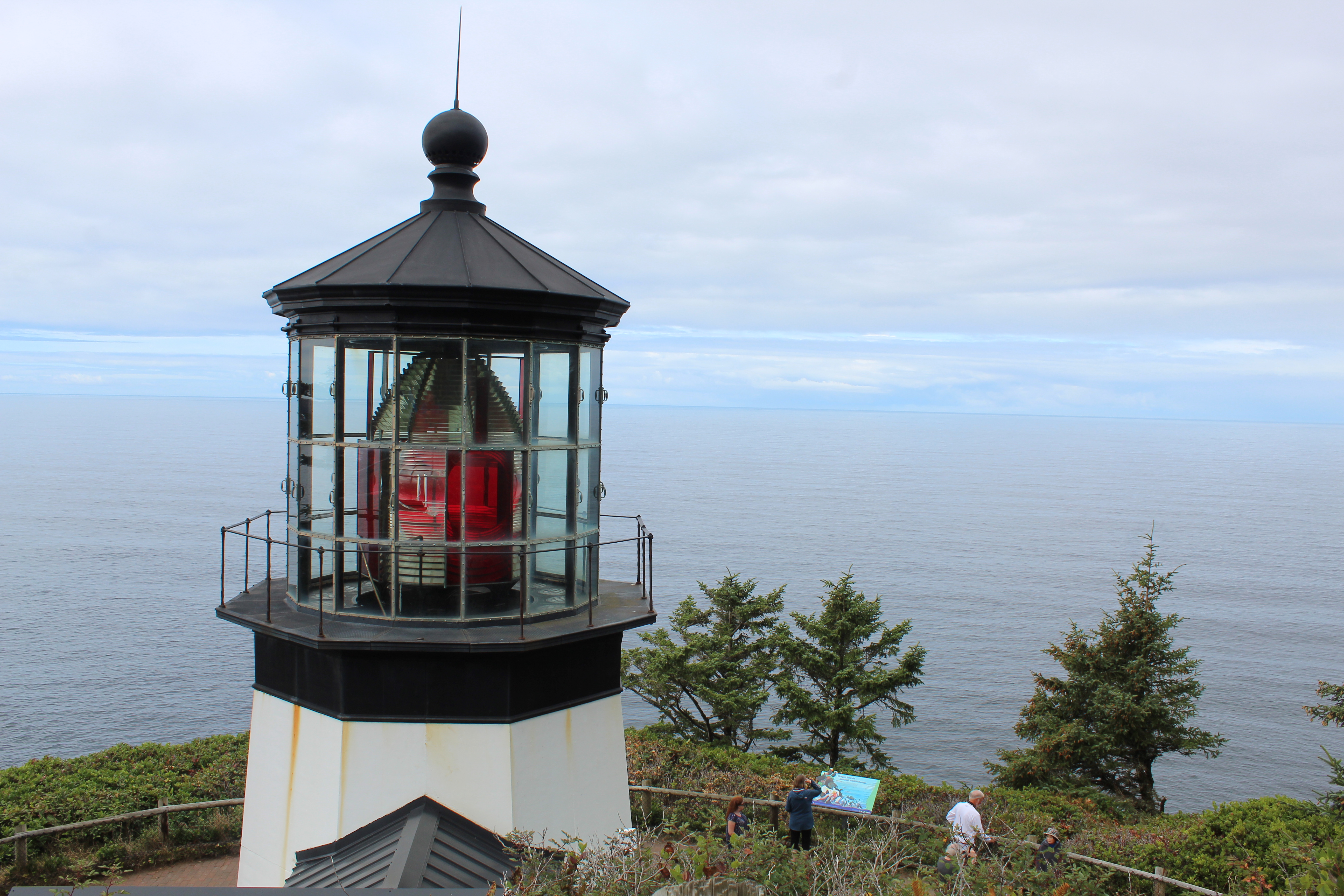
The first lighthouse we visited on our trip was the Cape Meares Lighthouse, about 20 minutes from Tillamook.  This was the first lighthouse Amber and I got a passport stamp for on our honeymoon in 2017.  The lighthouse was constructed in 1890, and its tower is only a mere 40 feet high.  Certainly not tall for Oregon Coast standards, but it sits elevated on a bluff and the First Order Fresnel lens has a focal plane over the ocean of 223 feet.

Addie was very excited to see the lighthouse and she had a huge grin plastered on her face as she clutched her passport, eager to get it stamped.


During the trip, we had planned a full day to go North and visit the Astoria area.  I love that part of the coast, and I have written about the history of the area before so I won't rehash that.  The main things on our list were taking the kids to Lewis & Clark National Historical Park (Which Addie absolutely loved running around and exploring the replica of Fort Clatsop)...


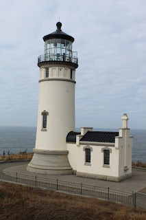
... also taking the kids to Cape Disappointment & North Head lighthouse (which Addie was thrilled to see those lighthouses as well)...



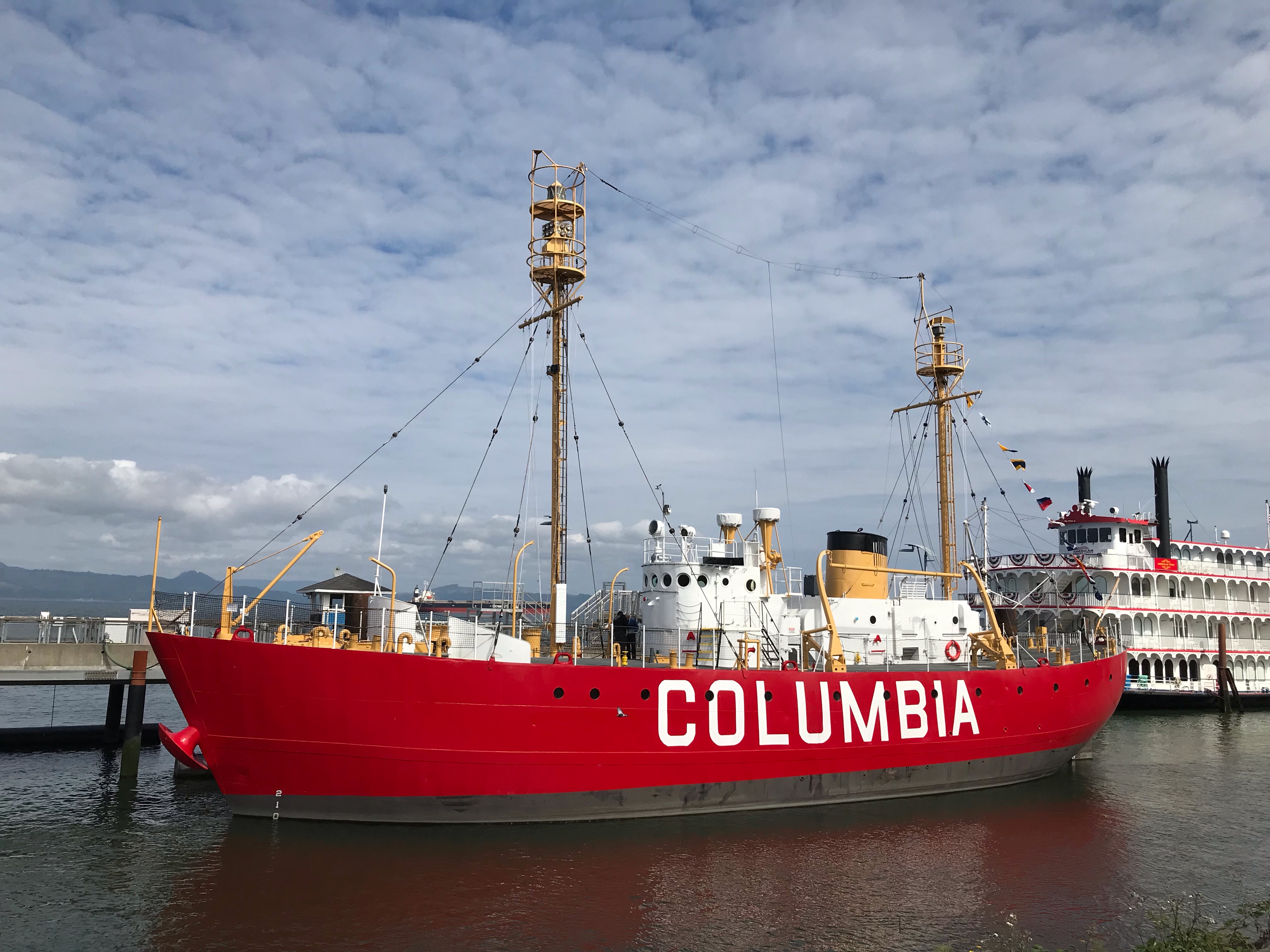
... But our main reason was to visit the Columbia River Maritime Museum in Astoria.  The museum features fabulous displays and exhibits about the local history, WWII history, the operations of the US Coast Guard, and lots of information about the shipwrecks in the area.  The Columbia River Bar is nicknamed the "Graveyard of the Pacific" due to the dangerous waters around the mouth of the river.  The museum also features the Lightship Columbia, which was essentially a lighthouse on a ship that spent time anchored at the mouth from 1950 until 1979.  It was the fifth and final lightship to be stationed there.  It was also the final lighthouse stamp Amber and I needed for the Oregon lighthouses in our Passport.  However, it was just our bad luck that it wasn't open for tours while we were there because of needed repairs.


(Addie & Bridger are off to a great start on their Lighthouse Passport)

Again, I'm not writing about how we spent a lot of our time on our trip, but I will end with this.  Amber and I have certainly had to adjust how we sightsee and go on road trips now that we have two kids.  We certainly learned how little attention span they have and we were forced to race through the Maritime Museum and not view it at our own pace.  But it is absolutely wonderful to be parents and pass on our love of history and scenery to our kids, and hopefully as they grow up they will begin to appreciate it.  And there is something incredibly satisfying about watching your toddler be enthralled with playing on the beach for the first time in her life while you show her how to built sand castles...


Tuesday, October 5, 2021

Utah Road Trip Part 4

 First thing in the morning Emily and I made breakfast: and then we zipped off to Priority #1 for the day.  Go to the Gifford house first thing that morning when they opened, to load up on pie.  At this time of day they were fully stocked so Emily and I both got strawberry-rhubarb pie and I grabbed a cinnamon roll to split with Amber.

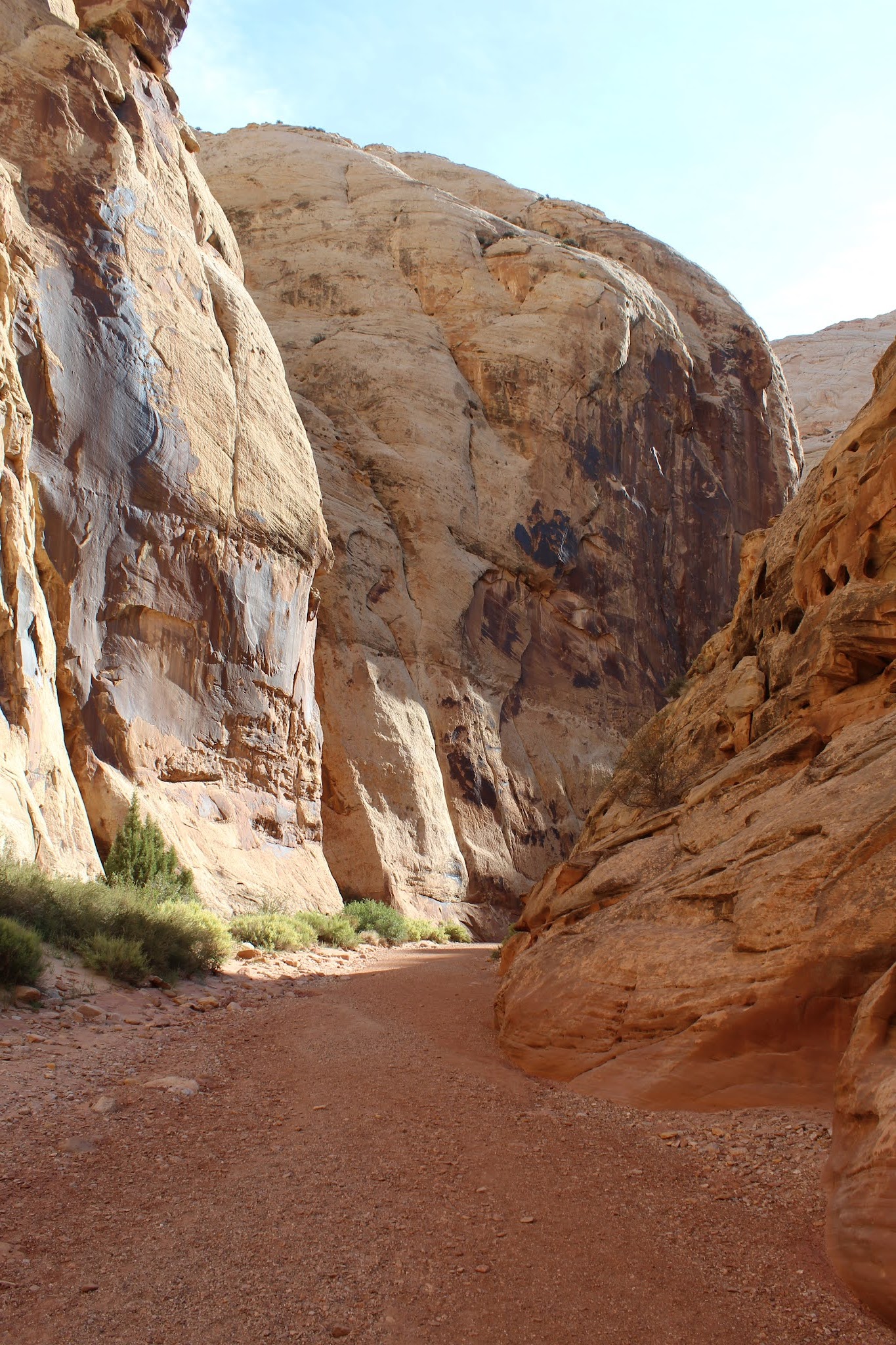
Then it was time for the second priority: Grand Wash Trail.  It is pretty similar to the Capitol Gorge Trail, except it has some sections of canyon that are narrower.


After we finished up our hike we headed back to camp to have some lunch.  Then while Amber & Addie rested, Emily and I embarked on a more difficult hike that we had been wanting to do.  We hiked the Cohab Canyon Trail, and went to both overlooks.  Cohab Canyon had a reputation for being a hiding place for the polygamists when federal agents came to the area to enforce marriage laws.  Cohab is a "Hanging Canyon", or a canyon above another canyon.  It's a steep climb to get to the mouth, but definitely worth it.


You eventually hike out of Cohab Canyon and then there are a couple spur trails to take you to different overlooks of the Fremont River/Fruita area.  The views were incredible and even made me dizzy as I peered over the edge of the sandstone cliffs.


Emily and I hiked back down to our camp and visited with Matt, Amy, and their kids as they had stopped by to say hi on their road trip.  After they took off we loaded up in the car to check out a couple more sites before we prepared to end our time at the park.  We checked out the historic Fruita school that the Park Service has preserved, as well as some petroglyphs from the Fremont people, before white settlers arrived in the area.


Our final stop was an area called The Goosenecks.  It's jaw dropping to see and the pictures don't do it justice.  Sulphur Creek is far below and the canyon seems to come out of nowhere.


When we had finished up exploring the area a bit more it was time to make dinner and then settle in for the evening.  It had been a full day of adventures and it was going to be sad to begin the trip home in the morning.  Capitol Reef gave us one more surprise, however.  Beginning in early evening we began getting some thunderstorms in the area.  The weather was very moody for a while, but at one point the sun poked out from behind the clouds and illuminated the red rocks and one of the barns.  I ran over and took what is probably one of my favorite pictures of the trip.


In the morning we were packed up and on the road before 8am.  It was sad to leave Capitol Reef- It moved into my favorite National Park that I have visited so far, barely edging out Theodore Roosevelt NP in North Dakota.  The next couple days would be mostly driving, but we had one more stop we wanted to squeeze in on our way back home.


When we finally arrived in North Utah in mid-afternoon, we only had a couple hours to explore this park.  That meant no auto tour or hiking for us on this visit, so we focused mostly on the Visitor Center and seeing one of the steam engine demonstrations.

Golden Spike National Historical Park commemorates the meeting of the Union Pacific and Central Pacific Railroads completing the nation's first transcontinental railroad on May 10, 1869.  I won't drone on about the history: You can read an excellent book by Stephen Ambrose called "Nothing Like It In The World" that gives a great in depth analysis of the railroad from pre-planning to completion.  But it is worth noting that in this desolate area of Northern Utah both railroads were continuing to build grade and had even passed each other because no official meeting point had been set.  But Congress finally determined the meeting point to be Promontory Summit.  Thus the ceremonial driving of the golden spike was planned, and the Central Pacific's locomotive named "Jupiter" and the Union Pacific's "No. 119" met in the middle.


The Park Service operates replicas of both locomotives and during the summer they do demonstrations for the public.  We were able to watch the No. 119 do a demonstration run late in the afternoon.


I would have loved to have spent more time exploring the area, but we just didn't have the time as we still needed to get checked into our lodging in Logan for the night and buy groceries.  But Golden Spike does also offer hiking and self guided interpretive auto tours along the original railroad grades.  It was a great end to a very fun and memorable trip exploring parts of Utah for the first time.  It will be exciting to come back someday and explore more of Utah, but also visit Capitol Reef again.


And.... as a bonus.... here is a photo of the famous Preston High School, in Preston, ID.  Amber and I realized the next morning that it wouldn't take any more time to leave Logan, UT, and head back a different way through Preston, ID.  Every good Idahoan knows that Preston is the location for the unofficial Idaho State movie, Napoleon Dynamite.  We had to swing by the school and see those famous steps where Napoleon, Pedro, and Deb all hung out... 😁


Sunday, October 3, 2021

Utah Road Trip Part 3


Driving into Capitol Reef National Park was an incredible experience.  The towering red rock cliffs tower above you, and transport you into a new world.  We admired the scenery as we drove into the Park and got set up at our campsite we had for two nights in the Fruita Campground.

Capitol Reef is a place full of history, interesting geology, and stunning surprises around every rock.  The area is dominated by the 100 mile long geological feature called the Waterpocket Fold.  This incredible formation is a stretch of rock layers in the Earth's crust that was uplifted, folded, and then subjected to massive water erosion that scoured the terrain.  Evolutionary geologists (and the US Park Service) will try to tell you it took millions upon millions of years for the sediment layers to be deposited.  The Park Service even tries to tell visitors that the rock layers folded but were not broken.  When was the last time you saw a sedimentary rock bend and not be broken?  How about 100 miles of hundreds of rock layers?  It certainly takes more faith to believe that wild story than that of Genesis Flood account.  Massive sediment deposition is all across the American Southwest.  The mountains being raised out of the flood waters caused the still soft layers to bend and massive amounts of water sheeting off the continent scoured the landscape clean.

Like a lot of places in Utah, Capitol Reef was first settled by Mormon pioneers, in the 1880s.  The Fruita District, as it is called now, was the main area of settlement.  The settlers planted orchards, gardens, raised livestock, and carved a simple yet satisfying existence out of the desert oasis along the Fremont River.

We set up our camp in Fruita and then went to go check out one of the apple orchards first.  We were worried most of the apples would be picked already, but that worry was misplaced.  There were plenty to go around.  

While Emily, Amber, and I filled bags Addie had fun scrounging apples from the ground.  


After finishing up loading up on apples we still had some time before evening, so we decided to drive the scenic road through the Northern part of the park.


When we got to the end of the pavement we decided to drive down the Capitol Gorge Road and see if we could find parking.  After the seemingly long drive and the beautiful scenery we reached the trailhead and did get lucky with a parking spot.

Capitol Gorge used to be the only easily traveled path through the Waterpocket Fold, until the 1860s when UT route 24 was constructed.  Mormon pioneers used this route heavily to travel through the area, and plenty of them left lots of evidence on the canyon walls.  You can also still see metal poles hammered into the canyon walls that were used to hold telephone wires in the early 20th century.


By the time we hiked back out of Capitol Gorge, we were hungry and tired.  We headed back to camp and made a taco dinner.  But the real treat was our pie from the Gifford House.  We all ended up getting the last mixed berry pies that they were selling.  We enjoyed the treat and then settled in for the evening to prepare for the next day which would be our full day at Capitol Reef.


(Post Pie Selfie)