This past weekend, Amber and I were up at 4am to do a quick trip out to the Pacific Ocean. We left Pasco, and it took us a little over 5 hours to get to Astoria, Oregon. Astoria sits right by the mouth of the Columbia River and is known for being the oldest settlement west of the Rocky Mountains. We had two main goals for our quick weekend trip. 1. See every lighthouse in the area and get our USLHS Passport stamps, and 2. See more Lewis & Clark history.
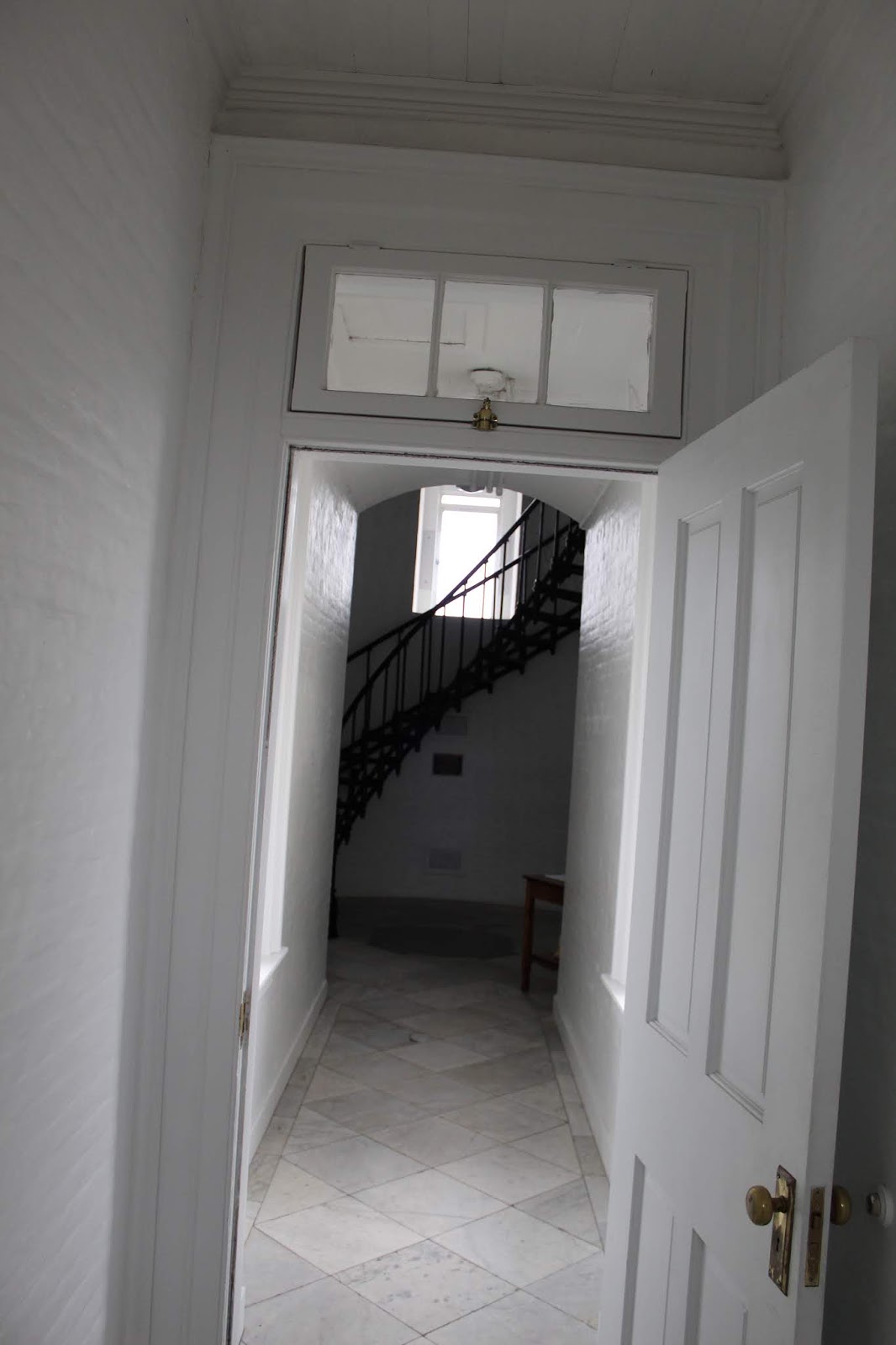
We started off by heading to Cape Disappointment, on the Washington side of the river's mouth, first. In 1856 the first lighthouse, known as Cape Disappointment Lighthouse, was built.
The light was needed to help mark the entrance to the Columbia River. According to somebody above my pay-grade, the Columbia River Mouth is the 2nd most dangerous in the world. The only one more dangerous is the mouth of the Amazon River in Brazil. Because the Columbia carries so much silt and sediment when the river meets the Pacific Ocean it drops immense amounts that create ever changing sand bars. These changing conditions combined with frequent storms create treacherous conditions for ships. Over 2,000 ships have sunk in these waters off Oregon/Washington, earning it the nickname "Graveyard of the Pacific".
The new lighthouse certainly helped, but it could not be seen around the headland by ships approaching from the north. To solve this problem, a second lighthouse was built on Cape Disappointment just 2 miles away as the crow flies. It is known as the North Head Light.
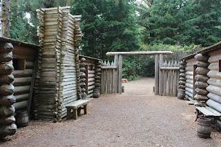
After checking out the lighthouses, we crossed back over into Oregon to explore some more Lewis & Clark sites. On their arrival to the Pacific, they combed over the whole region surrounding the mouth of the Columbia River. For days they endured bad weather on the Washington side, until they made the decision to cross south and built a fort in which to spend the winter. This fort was named Fort Clatsop, after a local Indian tribe. They spent December o 1805 to March 1806 in this location. Today, Lewis & Clark National Historic Park preserves the area they wintered, and a replica of Fort Clatsop stands, based on drawings and dimensions laid out in Lewis's journals.


We watched a film and explored the exhibits and some trails before continuing on our day of adventures. We opted for Fort Stevens State Park. It was created to preserve beaches and military installations. Lots of bunkers, gun emplacements, and radar stations are all over the place. They date back from the Civil War era up to World War II. In addition, Fort Stevens is the location of a Japanese submarine attack during World War II. The sub launched about fifty shells against the area before slipping away at night.
Amber and I had time to check out one of these emplacements, but our real focus was seeing Oregon's most famous shipwreck. It was called the Peter Iredale. She was a British steel sailing vessel enroute to Portland. On October 25, 1906 she was waiting out a fierce storm that prevented her from entering the Columbia River. The ship was driven ashore and became stuck in the sand due to the storm. No lives were lost, but the ship was abandoned. As a result it quickly became a tourist attraction.
At this point in our evening, we were about ready to call it a day. We made a run to get gas and some candy before checking into our Airbnb room for the night. We heated up some dinner, showered, and slept for about 10 hours that night.
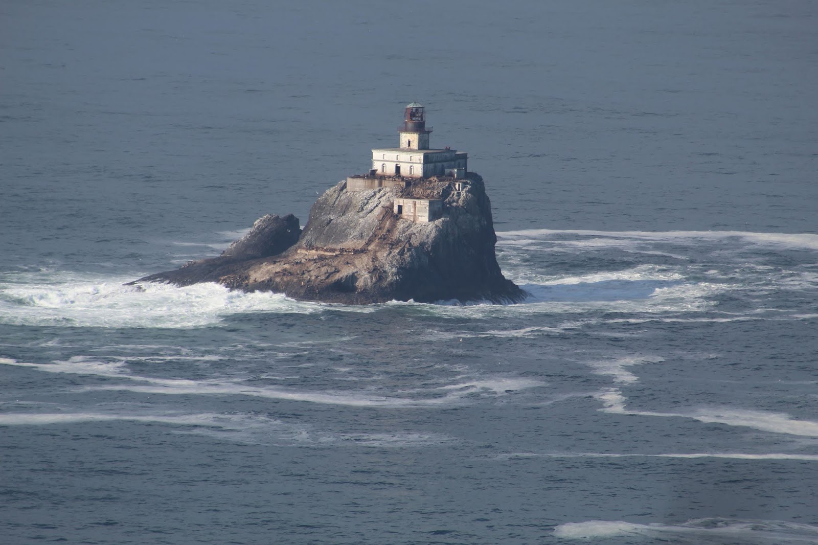
The next morning we really only had one main goal for the day: Try to get a view of Tillamook Rock Lighthouse. It was the last Oregon Coast lighthouse we had yet to see and get a picture of. I had tried in 2012, but the viewing was obscured by the all too common bad weather. It is a mysterious sentinel isolated over a mile offshore.
We headed down to Cannon Beach and attempted to find a historical marker/monument about the "Salt Works" where the Lewis & Clark expedition had sent men to boil sea water and obtain salt for their return in the spring. But we couldn't find it, so we continued on. We arrived in Cannon Beach and made the windy drive up to Ecola State Park. Our plan was to hike Tillamook Head. This was the farthest south Lewis & Clark explored, and he described Tillamook Head as one of the steepest hills he had ever climbed (funny since he crossed over the Rocky Mountains and they were much worse).
It was a gorgeous morning for a hike, and it was neat to think we were once again walking in the footsteps of the famous expedition. At the top of the head we hiked a short spur trail and were finally rewarded with the view that I had wanted to see for years...

The Tillamook Rock Lighthouse was another aid to Columbia River navigation and it was finally lit for the first time in 1881. The construction, upkeep, and stories surrounding this remote lighthouse is quite a remarkable story, surrounded by both fact and legend. But it took workers 7 months alone just to level the top of the rock on which to build the lighthouse. They were stuck on their island prison the entire time. They lived in tented bolted to the rock and endured countless fierce storms. Once the lighthouse was completed it quickly gained the nickname "Terrible Tilly" due to the horrible and lonely conditions. The fierce winter storms routinely drove waves over the top of the lighthouse. Supply runs were not consistent due to constant bad weather.
The lighthouse was deactivated in 1957. Today it sits abandoned and decaying 1.2 miles offshore. More often than not it is shrouded in fog and secrecy. Being able to view it today finally meant that Amber and I had officially seen every lighthouse on the Oregon Coast. We went into Cannon Beach to get out Lighthouse Passport Stamp, and then began the drive back to Pasco....
I will close this post with a video shot I was able to get with our camera. I'm quite pleased with the quality considering the great distance offshore this lighthouse really is.